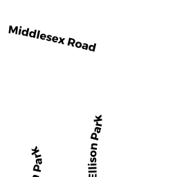
124 ELLISON PK
Owner Information
ABRIMIAN, VAHE & NARTOOHI N.
124 ELLISON PK.
WALTHAM, MA 02452-6181


Property Details
124 ELLISON PK is classified as a Single Family Residential (Colonial).
The primary structure on this property was built in 2005. There are 3,193ft2 of built area within this property. There is 3,193ft2 of residential/living space within this property.
124 ELLISON PK is valued at $988,500. The land is valued at $311,700 and the structures are valued at $675,100. There is an additional valuation of $1,700 on this property.
The most recent deed for 124 ELLISON PK is recorded at the local registrar in Book 48932, Page 498-49. 124 ELLISON PK was last sold on Wednesday, January 31, 2007 for $640,000.
Assessment data from fiscal year 2022.
Flood Data
According to the FEMA National Flood Hazard Layer, this property does not appear to be in a flood zone. It may also be in an area not yet reviewed. Nonetheless, confirm this information prior to taking any action.
To view the flood hazards around this property, create a FEMA "Firmette" Map of the area around 124 ELLISON PK.
Broadband Internet Providers
| Provider | Type | Bandwidth (mbps) | |
|---|---|---|---|
| Verizon New England Inc. | DSL | 1 | 0 |
| Crown Castle Fiber | Fiber | 0 | 0 |
| Comcast | Cable | 1000 | 35 |
| RCN | Cable | 500 | 20 |
| RCN | Cable | 1000 | 20 |
| T-Mobile | Fixed Wireless | 25 | 3 |
| GCI Communication Corp. | Satellite | 0 | 0 |
| HughesNet | Satellite | 25 | 3 |
| VSAT Systems, LLC. | Satellite | 2 | 1 |
| Verizon New England Inc. | Fiber | 940 | 880 |
| Viasat Inc | Satellite | 100 | 3 |
Broadband service provider data from December 2020.